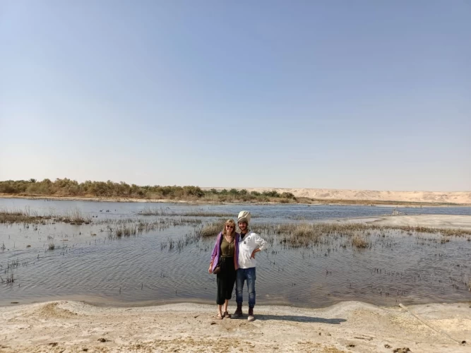
Ghoroud Samuel Fayoum
As for how to get to it, Samuel's Grove is about 180 km from Cairo by road, southwest of Fayoum and on the outskirts of the Western Desert. Therefore, Samuel's Ghoroud is still the closest Ghoroud area to the Nile Valley, and Cairo in particular has a distinct diversity of types of Ghoroud.
Samuel Ghoroud map
The main area of Samuil Ghoroud stretches for a length of 45 km from North to South and about 10 km on average from East to West in an area completely covered with Ghoroud with some rocks and pierced by small rocky plateaus in some areas.
The field of Ghoroud extends south with Ghoroud gradually decreasing in density until it intersects with the Western Assiut road and ends in the center of the Minya Valley west of the city of Meloy in the so-called Samalot Grodd. And there it looks unusually and picturesquely, where the ghettos are mixed with roses, and the movement of the roses through the fields seems obvious because they are surrounded by some high palms until they are almost completely submerged.
Boundaries of the Ghoroud Samuel district
From the north: the southern end of the lower Wadi Al-Rayyan Lake and Wadi Al-Rayyan Road.
From the South: Mount "ASAS".
From the East: it is bordered by Mount Qalamoun and the monastery of St.
From the West, it is bordered by the mountain of tribal peaks.
Entrances from the road
Entrances to any area begin with an exit point from a certain road leading to a long or short pylon into the "play" area in the heart of the Ghoroud. The exit points from the road are often called"pestle heads"(in English Trailhead).
In the case of Samuel's Ghoroud, its northern entrance is from Wadi Al-Rayyan Road, which penetrates the Grodd itself in its northernmost part, which makes the game start immediately after exiting the road on the pestle heads. This entrance also represents the shortest route ever from Cairo to the play area.
Specific entries must be adhered to either entry 1, entry 2, or entry 3, as will be indicated later, depending on the level of the trip and the skills required in it.
Entering from other than these entrances to reach the high ground area will be very difficult due to the presence of low trees with roots that can puncture tires, with spikes that can stop cars, and bury them.
Warning: entering without a guide from the clubs and leaders of the good clubs may result in the loss of your car or death.
Pestle head 4×4 No. 1
The coordinates of the navigation device (English GPS coordinates): located at 29.0575812 N 30.4133725 E
It enters the dusty brush area between the Northeast and Northwest parts, where driving is easy and there is a lot of traffic, and where there is a flag of pipe rock to the South.
Pestle head 4×4 No. 2
The coordinates of the navigation device (English GPS coordinates): located at 29.0588913 N 30.4323335 E
It begins on the north-eastern part, where the swords are shorter and there are no sand seas.
Pestle head 4×4 No. 3
The coordinates of the navigation device (English GPS coordinates): located at 29.0806286 N 30.3426813 E
This entrance is the shortest way to the sea of the sands of Ghoroud Samuel, away from the Sabkha or crossing by the width of Swords.
Warning: this pincer head leads to an area that only the first or second level of the owners of the 4x4 can handle and should not be secured by others because the area is dangerous for those other than those levels.
Types of Ghoroud
Unlike other areas that have sand with a high content of silt, these grods are almost pure sand and do not contain any silt or clay.
As we know, this fact (that the sand has no silt content) makes the sand completely loose, which poses an even greater challenge for the Rough Riders who roam the area.
Compare this with the Ghoroud of the domes area, which contains a clear percentage of silt that makes driving on the Ghoroud easier.
Map of types of Ghoroud
The generous reader will find in the article of Al-ghurud a hopeful explanation of all the types of dunes that can be found in nature and their forms. Most of them are in the Ghoroud of Samuel, where there are the three main types of Ghoroud:
The type of "sword" with a custom (sharp cut) appears yellow on the map, or rounded (whale back) and appears light brown.
The type of "sand sea" (or complex, as some call it) appears in green color on the map, which has contiguous norms in length and width and divides the field into a group of dunes of different depths.
The crescent moon is shown in a purple color on the map, where its horns always point south in the direction of its course through the air.
Ghoroud Samuel district is divided into two main parts: the north and the South.
North Ghoroud Samuel region, with its two parts
The area north of Ghoroud Samuel stretches for a length of 20 kilometers. It is also divided into two main parts, the north-western part (1) and the north-eastern part (2). The two parts are separated by a brush covered with gravel, rocks, and dirt, and it looks like a corridor (corridor) about 1.5 kilometers wide, but in fact, it is a brush between two adjacent Ghoroud areas. The pipe Rock is located in the middle of this dusty clay brush.
The north-western part (Region 1 in the map) of Samuel's Ghoroud
It occupies the western part along 20 km from North to South and up to 2.5 km south of the flag of the pipe rock. The average width of this field is 3km from East to West.
This is the most important site for excursions, and therefore it is not recommended as a camping place.
The north west region is suitable for trips to all levels of off-road driving in Samuel's Grodd and is explained as the levels on this page.
On the eastern side of the area, there are many swords with rounded and rounded edges (the back of the whale) with a width of about 2 km. The western side is almost completely covered by the formations of the sand sea (green color on the map) and is represented by a narrow strip 1 km wide.
The rocky base of the place is almost flat in all directions and its slope is at an altitude of about 50 meters (above sea level). If the reader is interested in geometry and understanding shapes, let's take a vertical section from East to West. Then we will see that the surface of the Sandy grotto gradually increases in height from East to West until it reaches a height of 100 meters (above sea level), which means that the maximum height of the grotto reaches 50 meters above the rocky bottom (equivalent to a building of 17 houses). From this high altitude, the western side begins to descend rapidly to reveal the rocky bottom completely, at a horizontal distance of no more than 300 meters.
Swords and cordials of Ghoroud Samuel
The north-west region contains wide, distinctive corridors near its center with a width of up to 50 meters and a length of 8 km. The fairways are almost perfectly level except for some minor bumps. Congratulations, describe it as an airstrip. Despite the presence of violent bumps on both sides of the lane, some drivers managed to reach 150 km/h and more in the lanes (warning: only for professionals. The high speeds on the sand grods cause poor handling in the best off-road cars).
Samuel Ghoroud and seas
The "sea of sand" format is available in this Grodno. The Ghoroud Samuel Sand Sea area (the green area on the map) is considered one of the most important and difficult main destinations for expert off-road car drivers. The long Sand Sea field in our grodna is a narrow field of grods with broken grooves in all directions, including deep, hard-to-reach kayaks. Its width varies from 1 km to 250 meters in its narrowest areas.
The north-eastern part( Region 2 in the map) of Samuel's Grod
It is approximately 5 kilometers from East to West and 15 kilometers from south to Wadi Al-Rayyan Road in the North, and ends at Mount Qalamoun in the South. They are almost all covered by one species, the sword grouse.
Southern District of Ghoroud Samuel
This is the part where there are oases. In the middle of its northern part, there is an uninhabited oasis called "hatya Al-kharif", and to the East, in the bosom of Mount Qalamoun.
As for the southern part of it, it extends about 25 km after the flag of the pipe rock and up to Mount ASAS in its southernmost part, where the grods noticeably decrease and turn mostly into crescent moons. The rest are very few forms of sand seas and swords separated from each other by brushes of zlat.
When the enterprising reader looks at Samuel's Ghoroud, he notices how the grodna field here is a natural extension of Abu Hanish Ghoroud to the far north, where north-westerly winds dominate most of the year in transporting sand particles from North to South in Samuel's Ghoroud.
To the south of Grodna, it is clear that Samalot's Ghoroud is also a natural extension of Samuel's Grod.
It is worth noting that "Ghoroud smalut" is a beautiful phenomenon of dunes of all kinds (Seef, Crescent, etc.) penetrating the green fields of the Nile Valley and showing natural contrasts at their maximum and harshest limits.
Where is Samuel Ghoroud on the Orcs Squares project?
As part of the club's navigation equipment development project, the Orx navigation program, which is currently available from the Android Market on a free basis, has been downloaded with maps of Egypt covering the areas of Grodna.
The most important Square for saline is J6.
And also in J5, K5, K6, J7, and K7 to cover important parts of the road and the surrounding desert, in addition to Fayoum, where there are some of the lodges where club members stay.