Latest Articles

  • Atlas Studios

    Atlas Studios

    Atlas Studios, also known as Film City, is a well-known film studio in Morocco. It has been used as a filming location for many international movies and TV shows.

  • Rabat

    Rabat

    Rabat is the capital city of Morocco, located on the country's Atlantic coastline. It is situated across the Bouregreg River from the city of Salé and forms the Rabat-Salé urban area. With a rich history dating back to the Roman era, Rabat is known for its blend of modernity and traditional Moroccan architecture.

  • Erfoud

    Erfoud

    Erfoud is a city located in eastern Morocco, known as the gateway to the Sahara Desert. It is a popular destination for travelers seeking to explore the stunning desert landscapes and experience the unique culture and hospitality of the region. Erfoud offers opportunities for camel trekking, visits to the nearby Merzouga Dunes, and exploring the local markets and traditional crafts.

  • Merzouga Dunes

    Merzouga Dunes

    The Erg Chebbi Dunes, also known as the Merzouga Dunes, are a stunning natural wonder located in southeastern Morocco. These majestic dunes stretch as far as the eye can see, with some reaching heights of up to 150 meters. The Erg Chebbi Dunes are a popular destination for travelers looking to experience the beauty of the Sahara Desert.

  • Khenifiss National Park

    Khenifiss National Park

    Explore the beauty of Morocco's natural reserve at Khenifiss National Park. Located in the southwestern part of the country, this park is home to diverse wildlife and stunning landscapes. Visitors can enjoy hiking, birdwatching, and exploring the unique ecosystems found in the park.

  • Ouzoud Waterfalls

    Ouzoud Waterfalls

    The Ouzoud Waterfalls, located in the Atlas Mountains of Morocco, are a stunning natural wonder and a popular tourist destination. The falls cascade over a series of rocky cliffs, creating a breathtaking sight and a refreshing mist in the air. Visitors can hike down to the base of the falls, passing by olive groves and encountering local Barbary macaque monkeys along the way.

Darb al arbain | darb el-arbain caravan route

  • 05 16, 2023

Darb al arbain

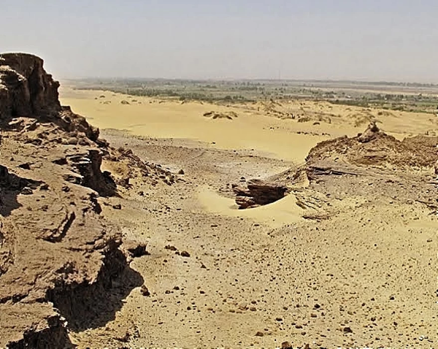
AL-ARBAIN started in Asyut went through Kharga, leapfrogged between the oasis of Bir Kiseiba, al-Shabab, and Selima, and ended its run somewhere in Darfur. From the medieval period onwards, it was one of the main conduits through which luxury goods and slaves entered Egypt from the south. It remains doubtful that its entire length was traveled in the Roman period, no firm evidence has surfaced at roadside sites south of Kharga.

The main link between Darfur and Egypt was a desert route known as darb al-Urbain or the Forty Days Road.

Beginning in the Darfur commercial center of Kobbei, it stretched north 1,117 miles through the oases of the Sahara to join the Nile just below the Egyptian town of Asyüt, and from there it proceeded directly to Cairo. Allegedly a fast courier could cover the distance in 12 days, though a caravan of several hundred camels and a thousand slaves might take anywhere from 45 to 90 days to complete the journey. Effective control of darb al arba'in necessitated the cooperation-willing or otherwise-of the Bedouin tribes whose territory the route passed through.

darb el-arbain caravan route 

 The size of caravans traversing darb al- arba'in varied considerably. Caravans of anywhere 2,000 to 24,000 camels were noted in the late- eighteenth century, though most were by the smaller end of this spectrum. The sheer difficulty of the route accounted for its importance since, unlike the riverine routes, it generally was free of banditry Slaves.

 Sudanese merchants of the Nubian diaspora began to monopolize trade in slaves and ivory. Slave trading continued sporadically thereafter but dwindled in the tace of new political and economic conditions in Sudan.


Tags:
Share On Social Media:

Egypt Tours FAQ

Read top Egypt tours FAQs

Darb al-Arba'in" is an Arabic term that translates to "The Forty Days Road" in English. It refers to an ancient trade route and caravan trail that traversed the deserts of Egypt and connected various regions of North Africa. This route played a significant role in facilitating trade, commerce, and cultural exchange across the region.

The Darb al-Arba'in route extended for approximately 1,200 kilometers (746 miles) through the Egyptian desert, connecting the Nile River Valley with areas in the Western Desert, such as the oases of Bahariya, Farafra, Dakhla, and Kharga. It then continued southwestward, leading to the Gilf Kebir plateau and eventually reaching the Sudanese border.

Key points and oases along the Darb al-Arba'in included:

   Bahariya Oasis: This oasis served as an essential stopover point for caravans traveling along the route. It provided a source of water, food, and shelter for travelers.

   Farafra Oasis: Located to the southwest of Bahariya, Farafra was another crucial oasis along the route, offering resources to caravans and travelers.

   Dakhla Oasis: Further along the trail, Dakhla Oasis was an important oasis town known for its rich history and archaeological sites. It provided a place for rest and resupply.

   Kharga Oasis: Kharga was the largest oasis on the Darb al-Arba'in route, and it played a vital role in supporting caravans and travelers. It was known for its agriculture and fortifications.

   Gilf Kebir: The Darb al-Arba'in extended to the remote Gilf Kebir plateau, which is famous for its striking landscapes and prehistoric rock art.

The Darb al-Arba'in route was historically used for trade in goods such as salt, gold, precious stones, and other commodities. It was also a route for cultural exchange and communication between various regions of North Africa.

;

Cairo Top Tours Partners

Check out our partners

EgyptAir
Fairmont
Sonesta
the oberoi